How the curb on the Upper West Side gets used, and a block by block plan for NYC DOT
My roleWrote and designed the report; project coordinator and the team’s link to DOT
WhenSeptember 2023 to May 2024, my NYU Wagner capstone
WithNYC DOT, the Columbus Avenue Business Improvement District and four classmates
Scale402 street observations and two street surveys, 72nd to 86th Street
NowDOT launched Smart Curbs on the Upper West Side in October 2024
01
The question
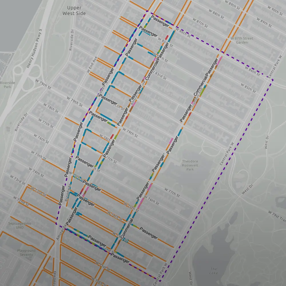
Who is the curb actually for? On the Upper West Side, the same strip of street has to hold parked cars, delivery trucks, delivery cyclists waiting for orders, buses and people trying to cross. Most of New York’s curb goes to parked cars. NYC DOT chose the blocks from 72nd to 86th Street, between Broadway and Central Park West, for its Smart Curbs pilot, and asked our team to find out how that curb is really used and what should change.
Four delivery cyclists answered, after repeated tries. We put that number in the report as it was, because a flyer with a QR code was clearly not reaching them.
02
The hard part
The curb changes through the day, and DOT’s data doesn’t show most of it. DOT’s data says what each stretch of curb is meant for. It does not say who double parks there, or where a truck unloads for hours. We had to go out and see it ourselves, five of us, in the cold weeks before the holidays.
Some people thought we were there to take their parking away and answered with that in mind. The group that leans on the curb the most, delivery cyclists, was the hardest to reach: they work to quotas, many do not trust surveys, and one Spanish translation does not cover the languages they speak. DOT and the BID told us the delivery app companies were very hard to get data from, too.
03
How I ran it
We tracked the project’s seven phases on one shared Trello board, so five people with five schedules could see what was due and who had it. I group them into five stages here.
- September to October 2023Set up the teamWe signed a team charter on 3 October that gave each of us a role. I was project coordinator and the link to DOT. We met every Thursday, and I set the agendas with a teammate and kept the minutes.
- October to November 2023Learn the curbRead DOT’s Curb Management Action Plan and what San Francisco, Seattle and Washington DC had tried, met DOT’s planning teams for freight, parking, public realm and engagement, sat in on Community Board 7, walked the site, and wrote the data collection plan in November.
- 28 November to 22 December 2023FieldworkLogged 402 observations on the street with our own field tool from 28 November to 7 December, ran two street surveys from 4 to 22 December, and went to DOT’s public meetings on the pilot.
- January to April 2024Make sense of itAdded the BID’s and DOT’s merchant surveys, and put together our first findings in March.
- April 2024Write and designTurned the findings into a recommendations matrix, and wrote and designed the report.

We built our own field tool with a preset list of curb issues, so five people collecting on different days logged every observation the same way.
04
What I built
With the team, a field tool: pick an issue from a list, tag the spot, take a photo, and it lands in a shared spreadsheet in real time. Two street surveys, one for the public and one for delivery cyclists, in English and Spanish. A recommendations matrix DOT can sort and edit. Interviews with four people who manage or rely on the curb. A check of what we saw against DOT’s curb regulation data. And the final report, Curb Forward, which I wrote and designed.
Read the report →
NYU Wagner: Smart Curbs Initiative →
ArcGIS Online · QGIS · Adobe InDesign · Photoshop · Trello · Field Survey Design · Street Surveys · Stakeholder Interviews · Project Management · Report Design
We printed the survey’s limits next to the results, including a delivery cyclist sample of four, so DOT knew how far to trust each number.
We gave DOT the recommendations as a sortable spreadsheet, each tied to its citywide curb plan, so staff could plan with it and update it.
05
What we proposed
The matrix sorts every recommendation into four groups: efficient curb use, community needs, safety and accessibility, and technology. Some of what it asks for:
- On-street microhubs at the edges of the neighborhood, with room for cargo bikes, so fewer trucks drive in to unload in the travel lane.
- Daylighting at Verdi Square and at Central Park West and 81st Street, and rain gardens in the cleared space on blocks with higher stormwater flood risk.
- Camera enforcement of double parking, building on the cameras already mounted on MTA buses, since double parking is over before an officer can see it.
- A bike boulevard on West 77th Street, more bike parking on Amsterdam Avenue, and package lockers at grocery stores.
- 402 observations behind it, logged in the pilot area in late 2023, from double parking to delivery drivers using the curb as an unofficial loading hub.

06
Where it went next
- 1 May 2024: presented to NYC DOT and local partners.
- 2023-2024: featured by NYU Wagner as the Smart Curbs Initiative.
- 12 June 2024: DOT’s pilot proposal for the area went public, with new parking meters and loading zones (Westside Rag).
- 28 October 2024: DOT launched the Smart Curbs program on the Upper West Side.