Selling Flood Risk NYC
Objective
To analyze the intersection of NYC’s real estate market with future flood risks, providing data-driven insights into the potential impacts of flooding on housing values and encouraging transparency in risk disclosure.
Tags
Description
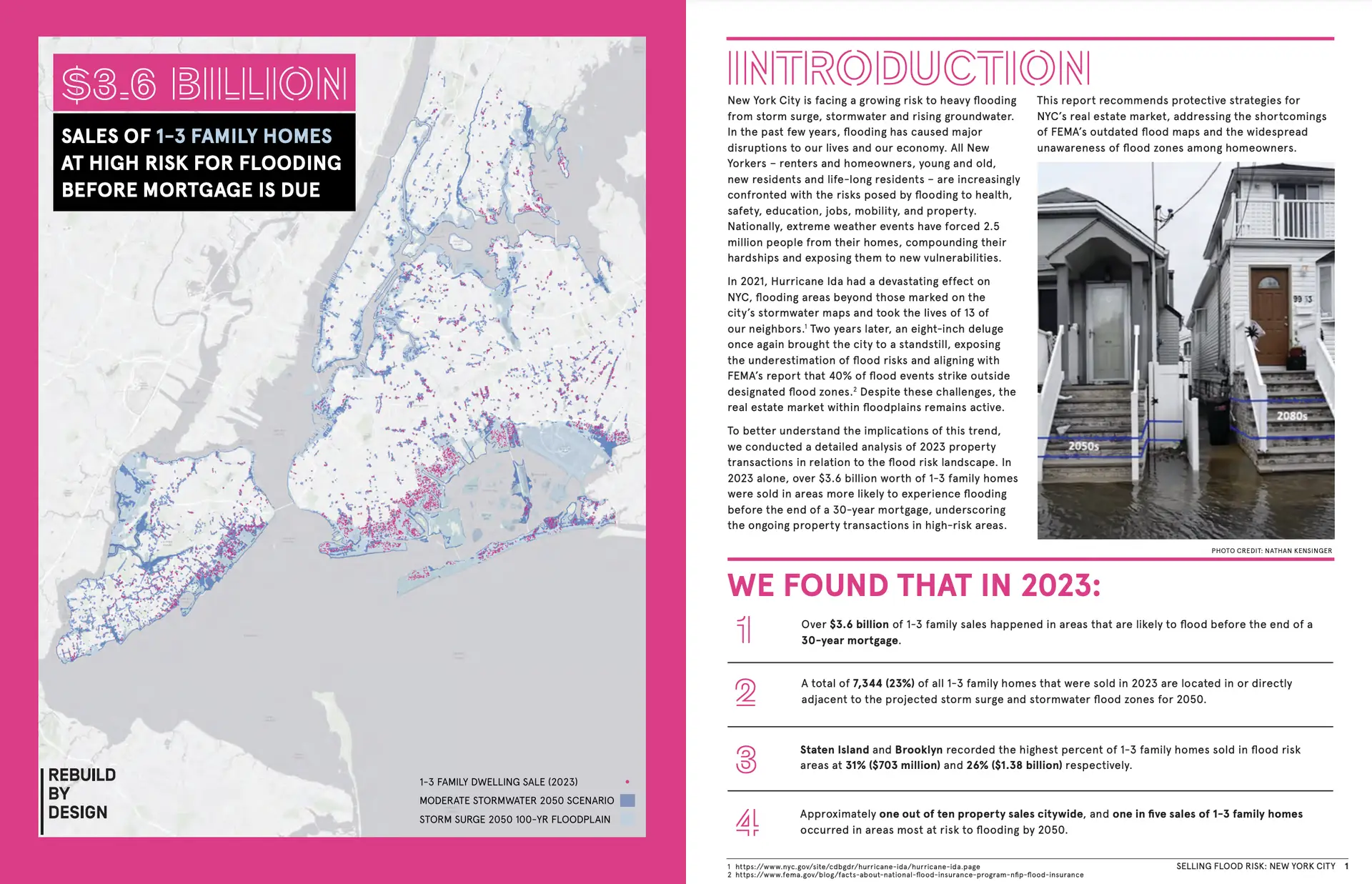
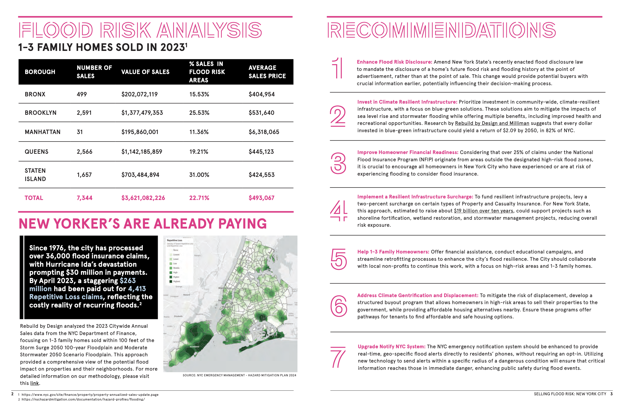
Selling Flood Risk NYC is an interactive map developed for Rebuild by Design and examines the financial and physical risks associated with real estate transactions in New York City’s projected 2050 flood zones. This analysis found that $3.6 billion worth of homes sold in 2023 fall within areas at risk of flooding from storm surge and stormwater events. The project provides a breakdown of borough-specific data, showing that Staten Island and Brooklyn have the highest percentages of at-risk home sales, with nearly one in five homes sold citywide located in projected flood zones.
The project includes an interactive map and accompanying report that allow users to explore neighborhood-specific flood risk data. Recommendations from the project suggest amendments to New York State’s flood disclosure laws, investments in climate-resilient infrastructure, and upgrades to real-time emergency alert systems. Selling Flood Risk NYC has been cited in media coverage and discussions with policymakers, providing stakeholders with information to inform future real estate and climate resilience policies in New York City.
View the interactive mapping tool here >>
Featured in the following media outlets:
- Aug 22, 2024 – New York Amsterdam News: Double-Whammy: How Heavy Rains and High Tides Hurt NYC’s Black and Brown Neighborhoods
- Sept 14, 2024 – The New York Times: Home Sales in Flood Zones Are Booming. Here’s Why Buyers Take the Risk


